Walked June 4, 2002.

I took the bus to Kingston from Putney ... which seemed like the longest bus ride of my life. Not in distance, of course: Kingston isn't all that far from Putney as the roads go. And the traffic wasn't a problem -- the roads were, for the most part, clear. At least they were clear in front of us. Behind us they were an angry, seething mass as our driver is crawling along the 2-lane roads at a rate best described as glacial.
But I got there, of course, and walked to the river.

I looked back upstream to pretty Kingston Bridge:

And continued down the path. Here's a look back upriver between Kingston and Teddington.


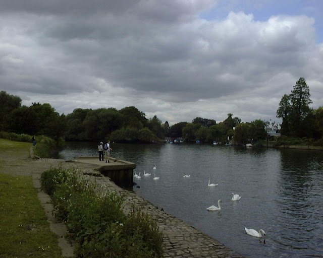
Soon I came to the Teddington Locks complex -- the largest on the Thames -- including boat rollers on the left.

The Barge Lock, Teddington, is 650 feet long, and designed to take a steam tug and six barges (!!!!).

I of course loved seeing this Rabies prevention sign on Teddington Lock:

I spotted this obelisk marking the boundary between the Thames Conservancy and the Port of London Authority jurisdiction, erected in 1909.

They're very serious about this, you see.

Apparently the land around here used to be gravel quarries, with a big man-made lagoon used to load barges. In the early 1960s, rubble from London's bomb sites was used to fill-in the quarries, bringing a variety of soils and plant seeds, which created a rich habitat. Sharp says 230 species were recorded there. This area, known as the Ham Lands, has a number of paths to explore. I spotted this, an elusive burnt-out car.

I walked past Eel Pie island (here's a pic of the downstream end), which was named in Victorian days, when people would take a steamer and drink ale and eat local pies here. Sadlly, I was on the opposite bank and couldn't visit.

A little further along, however, I neared Ham House, and looked back upriver to this view of Eel Pie Island.
Here's pretty Ham House from the riverside:

Wilbraham, the 6th Earl of Dysart, knocked down the old courtyard walls enclosing the front of the house, and reopening it up to the river. I didn't want to visit the house, but I did buy a ticket to the gardens:
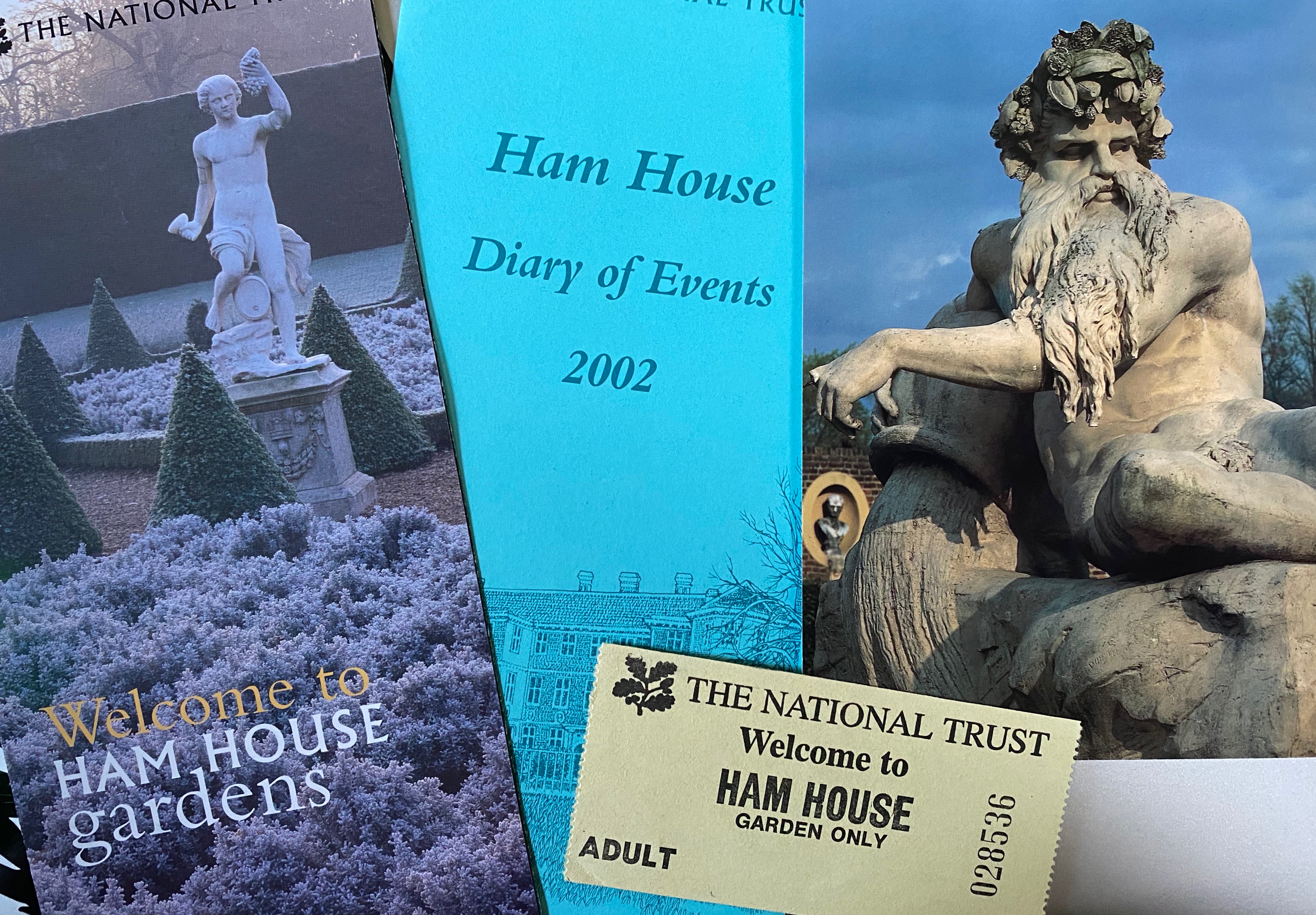
Why? To see this fella closer up:

Wilbraham also installed the Thames River God statue in 1800. Sadly I couldn't get right up to him, but still:

I poked around the pretty gardens; here's Ham House from the Cherry Garden:

I love these clipped plants -- the formality of it all!

And this lovely tree arch:

And this charming Coade Stone pineapple:

Eventually I knew I needed to move on, so I headed downriver to Hammerton's Ferry:

I decided to cross the river using the ferry because, well, why not?


I walked past pretty Marble Hill house, built in 1723 for Henrietta Howard, mistress of the future George II.

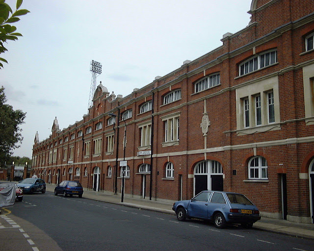
A little farther along I spotted the Star and Garter home, Richmond.

The Star and Garter had been a hotel in the 19th century, and hosted many famous guests.
This historic hotel commands the loveliest views in the Kingdom. No London fog. Highest class cuisines and wines. Excellent stabling, horses, and carriages. Billiards. — The Times, Thursday, 11 February 1897

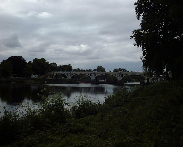
Further downriver I came to Richmond Bridge:

Here's looking downstream from Richmond Bridge to a new waterfront designed by Quinlan Terry blending old and new buildings.

Another view downstream from Richmond Bridge; I love the promenade along the river:

But I didn't linger, and headed on downriver under Richmond railway bridge and Twickenham Bridge. Apparently this stretch is known as the Duck Walk:

Look at this fun Egyptian detail on Twickenham Bridge:

And this lovely stairway railing on Twickenham Bridge:

Not much farther along and I could see Richmond Lock and footbridge ahead.
Sharpe says that Richmond Lock is a "half-tide" lock where the weirs are usually opened up for two hours on either side of high water, leaving the Thames tidal up to Teddington.


I had spent a lot of time at Kew when I was in grad school, but I never really spent time on the river. I was amused that the tide was very low.


And soon came to the moat and fence surrounding Kew Gardens. No visit for me today!

Then I spotted the entrance to the Grand Union Canal across the river, along with the remains of the once-busy Brentford Docks. The Grand Union Canal goes all the way up to Birmingham! I still have a tiny dream about a longboat holiday... at least till I remember that their top speed is 3 miles per hour ... slower than walking pace!


A bit farther along and I could see pretty Kew Palace, behind the fence at Kew Gardens:

And then, Kew Bridge:

The path goes under the bridge, and then , as Sharpe notes, "there is nothing of further consequence until you walk under Chiswick Bridge". Alrighty then!

To be honest, I didn't see anything of note until I arrived at the Public Record Office bunker:

The PRO has old and new halves. The new half looks quite grand -- stone and glass, pleasantly intermingled. The old half (above) looks... well... like a bunker. Which is fitting, actually, since it holds the nation's history in trust. Millions of documents, from hand-written city charters to parish rolls, from royal decrees to school records. I spent many days in there one wonderful summer, researching my (unfinished!) doctoral dissertation and I am still in awe of the place. But it was probably the most fun I ever had researching! If the archivists and security officers are sometimes snooty, it's because many people don't realize they're doing important work -- and preserving those documents while keeping them accessible to the public. One day I requested an Elizabethan document about dogcatchers and to my amazement it had been signed and sealed by Elizabeth I. I nearly fainted. All hail the PRO!
Well, here's Chiswick Bridge:

The farther I went downstream, the lower the tide. Here's a view near Mortlake:

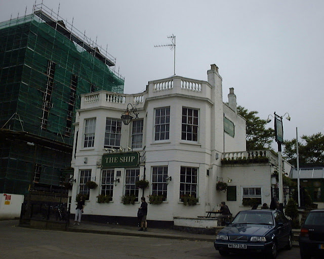
I popped into the Ship pub, Mortlake, for a pint. Nice stone terrace.
Then farther through Mortlake, where I saw a flood warning:

and -- Horror of horrors! -- The old Star Brewery in Mortlake, now churning out Budweiser.

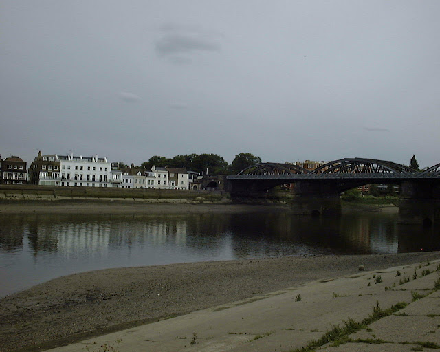
The path downstream to Barnes Bridge gets pretty narrow and overgrown.

When I got to Barnes Bridge the Concorde flew overhead. Noisy little bugger.

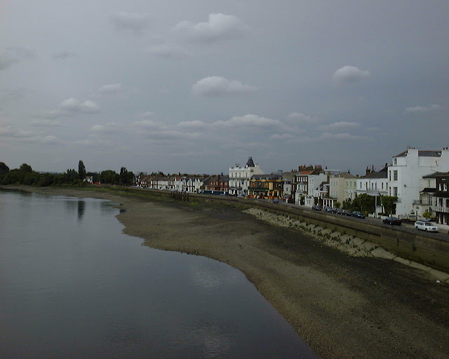
Barnes riverside, from Barnes Bridge:
I crossed the river and continued along the other bank; here's looking back to Barnes Bridge.
I spotted two more freshly burnt-out cars (a Jubilee celebration, perhaps?), Duke's Meadow:

I turned away from the river in Chiswick to visit the Church of St. Nicholas, to see Hogarth's grave:

While in the churchyard I saw this beautiful skull on a grave:

And -- perfection -- Whistler's grave. I mean, if you told me that Albert Moore designed the grave I'd believe you. (Actually it's by Edward Godwin...) It's interesting that the figures were missing from the tomb in 2002; there has since been a campaign to replace them with replicas.


But all I saw was really low tide:

I walked into the dry riverbed, near Chiswick, which was slightly thrilling:

Seriously, this was really cool:


I turned away from the river to look at William Morris's Kelmscott House, Hammersmith.

And, of course, the pretty Dove pub, right on the river in Hammersmith.

Then I arrived at gorgeous Hammersmith Bridge, designed by my beloved Joseph Bazalgette, "one of London's noblest builders" (saith Porter).

It's a pity it was so gloomy that afternoon:

When I emerged from underneath the bridge I noticed a lot of people sitting on the railings, looking downstream towards town. And not just a few idlers, but lots of people -- over 100. They seemed to be patiently waiting for something. Scanning around the mental microfiche I remembered that there was going to be an elaborate flyover -- biplanes to the Concorde, I believe. Of course, I thought I had read that the flyover was at 4:30, not 6. As I was only 1.5 mile from home, the weather was pleasant, and there was a cozy bench beside the river I decided to take a little break.
I didn't take any pictures of the flyovers, but I still remember it. All these different types of aircraft, all lining up to give the Queen a flyover for her jubilee -- apparently the management was very careful, with the Concorde swooping in at the last minute and slowing down as much as it could while the little biplane flew a fast as it could. It was pretty cool, and I'm not even an aircraft nerd.
I continued downstairs and looked upstream at low tide to Hammersmith Bridge:

I spotted this warning sign on the footpath in Hammersmith. Is it saying "dogs should not foul the footpath" or "dogs should not warm themselves by fires"?

Just downstream I saw the old Harrod's Furniture Depository, now full of posh flats.


Then I got to Fulham, nearly home. Looking upriver you can see architect Richard Rogers's office, in the funny round-roofed building on the far right.


I walked into Bishop's Park, and I think I spotted the Fulham Borough Council logo--maybe.

Across the river I could see the boathouses in Putney.

And as I continued along, I caught my first look at Putney Bridge, from under the plane trees in Bishop's Park.

Bazalgette built this one too. Bless him.

It's funny to look at even this picture of the Putney Riverfront -- a pub I visited in the 90s that had been there forever -- the Star and Garter -- had been painted purple and is home to a yuppie bar called "Bar M". I wonder what it looks like now in 2020?

My old stomping grounds! Thanks for the memories...
ReplyDelete