Pages

Tuesday, April 25, 2017

Urban rambling : the Washington Park Arboretum


On the way back from Otter Falls, after crossing another stream, Wil couldn't shake the feeling that his foot was wet -- not just cold from feeling the cold water through the boot, but actually wet. We stopped and Wil took off his boot and, sure enough, one of his boots must have had a hole in the Gore-Tex membrane. Later that day we stopped in at the Issaquah REI, took the still muddy and very wet boots to the front counter, and exchanged them for a new pair of boots, no questions asked. HUGE props to REI for just taking care of this!

Wil ended up buying a pair of Asolo Fugitive boots -- the men's version of my boots, the Asolo Stynger. They're a little sturdier than Wil's former boots, more "roughy toughy". So on Sunday we decided to test them out on a short walk, preferably with a bit of mud and some puddles. And our walk did not disappoint!

We drove out to the arboretum -- actually, the University of Washington Botanic Garden / Washington Park Arboretum -- and parked at the visitor's center. We set off meandering around the grounds. I should be clear, however, that we did not trespass on the bees.


(I can't speak to whether or not the honeybees remain in their pen...)

We did see lots and lots and lots of green. Crazy intense green.


With lots of twisty, turny paths, we really enjoyed our ramble. 


Wil, desperate to try out his NEW BOOTS, carefully stepped around the plants in this little creek. (That's skunk cabbage on the right... a plant I only know because a woman pointed it out to us on a hike once.)


The rhododendrons weren't in full bloom yet -- just some of the early varieties were colored up -- but I loved walking under this massive rhody tree and seeing this little living crutch:


Sometimes we all need a little help, eh?

We did pass some glorious azaleas on Azalea Way -- but the path will be much more vibrant in a couple of weeks:


On this gloomy day, we didn't have a lot of company in the gardens. 


After the genteel garden ramble, we set headed over to the Arboretum Waterfront Trail to Foster Island and Marsh Island.


I wasn't sure if this trail was still accessible, given the 520 Bridge construction. But when we crossed Foster Island we saw that a path remained under the freeway.

As we crossed the bridge to get on Foster Island we heard a weird noise and caught a heron fight. THIS IS MY BRIDGE!


We admired the view from the shore... after witnessing an awkward argument among friends. ("Well, okay, we can talk about the Mariners or the Seahawks if that will make you more comfortable.")


Then out across the floating bridge (kid sister to the Longest Floating Bridge In The World, next door) to Marsh Island... where we found the level of the walkway a few inches underwater.


Then we got to Marsh Island, which completely lived up to its name.


We headed out on a spur trail to take a quick look at the bridge construction and saw this: a ladder floating on a raft, adrift.


The trails on Marsh Island are essentially formed by adding chopped up bark and wood between two fixed planks. And when we have a lot of rain, including our Wettest April on Record (2017!), it just gets churned to mire. But this was a great way for Wil to test out his new boots!


We came to a few spots with really deep, watery mud... and each time there were a few trail runners hoping to avoid getting their feet wet. This caused a few backups ... and I didn't want to take pictures because I didn't want to upset the runners. So just picture mud with a bunch of branches laid over it in the vain hope of creating a bridge. And then picture me just slowly clomping through the water. And then picture me realizing that my boots are 7 inches high and the water was 7.5. Oh well -- my socks got wet at the top, but my feet didn't get super wet!

We made it to the far end of the trail, where the old MOHAI was, and then turned around and headed back. This trail is apparently endangered -- on Google it's listed as "permanently closed" already. But hopefully once the bridge construction wraps up access will be restored on the western end and they can restore the trail.

We headed back across the floating sections, which always make me think of that barrel bridge on Tom Sawyer Island at Disneyland.


And then, just as it started to rain, we got back to the car. Wil's boots had been tested -- and they passed the test with muddy, flying colors.

Arboretum Ramble

4.6 miles
236 feet elevation gain


Monday, April 24, 2017

Hike of the Week : Otter Falls, or This Time I Know It's For Real


We tried to hike this trail a few weeks back... but totally missed the turn off and headed up the Quartz Creek Trail instead. And then, when we got home, read a trail report describing deep "crotch deep" snow on the trail. So I suppose it was meant to be. 

We were trying to decide where to hike over the weekend. Our Kilimanjaro training plan called for a 3.5-hour hike, so I considered some hikes on the Olympic Peninsula, or in the southern Cascades. And then I remembered Otter Falls. The road was supposed to remain open until "late April"... was April 22 "late"? 

I checked the DOT site for the Middle Fork Snoqualmie River Road project and, happily for us, construction had not yet started for 2017. But I also figured that this was probably our last chance before 2018 to get back out there -- this was, indeed, the day. 

We drove out to the trailhead -- potholes don't frighten me anymore! -- and parked near the junction with the forest road. We then walked up and over the washouts toward the trailhead. (And back, because we had forgotten to put up our Discover Pass...). It's really beautiful and peaceful here -- and we eyed the quiet campsites with envy.

Not the Rolling Stones...
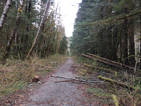
 The last bit of road between the washout and the trailhead:


And, finally, the trailhead. We were surprised to see three trucks parked here when we came off the trail -- but I suppose, with a high-clearance vehicle, we could have gotten past those washouts. 


The trail starts across this bridge -- crossing the Taylor River.


Four weeks after our last attempt, clearly things were a lot less snowy. April 22:


Roughly the same area, March 26:


And, clearly, spring was springing!


This time we spotted the trail sign, and actually followed it. Yay us!


The trail took us across a few stream crossings -- where we were glad to have Gore-tex boots. (What's that noise? Is that foreshadowing?)


But for the first couple of miles, only a tiny bit of snow.


We moved away from the river as the trail climbed, but there was still a lot of water coming down the hill. I liked this flat rock waterfall. Or is that a waterslide?


We came to a sturdy bridge over a largish waterfall just before 4 miles in. Perhaps this is Big Creek Falls? The map says this is Marten Creek, so probably not... but it was the biggest waterfall along the route (other than Otter Falls, of course!).


And then we continued on, the path getting increasingly narrow. I suppose this is because it has been difficult to get here in the summer for the past few years, and really snowy in the winter!


We tiptoed across a few more streams, admired the mossy rocks, and kept moving up the trail for a while.


Then we hit snow -- but it wasn't too bad. Never more than shin deep, and really mostly well compacted.

That's probably just a dog, right? Right?

As we dawdled at the edge of a wide, fast-moving, and not immediately easily crossable stream, two hikers caught up with us. They also paused, but soon set off across the rocks. Wil said, "Are you *sure* that THIS isn't Otter Falls?" But I was sure, since I'd seen pictures. (Amusingly, I would later discover that this creek flows from the lake at the bottom of Otter Falls, but that's neither here nor there.)

But we picked our way across, and headed up the snowy trail. I knew the spur trail to Otter Falls wasn't far ... but we couldn't spot it. We went past it, turned, and were inching back, trying to spot a trail heading up the hill... or at least some footprints in the snow... and I looked down and happened to spot this:


I stared at it for some time, suddenly realizing that it spelled E-R-F-A-L-L-S. Okay, the S was iffy at best. But it was clearly a sign, so we started walking up the hill, looking in vain for an obvious trail, but just heading up and up the hill. 

We came to a clearing on the edge of a hill and could see the falls ahead of us and a little beach below... but couldn't spot a way down. Out of the corner of his eye Wil saw an old glowstick on a log, and moving closer, we could spot a trail just across the log. Result!


I had seen pictures of the falls, but somehow thought they were maybe 10 feet high. Nope -- much much higher. And we had the place to ourselves, which was glorious. So we had a little break, ate a snack, ("take off your pack and have a snack!"), and just soaked it all in. Later my pal Luther posted on my FB page that his "teenaged jeans had holes in the butt from this place from sliding down in the summer -- the water was still ice flipping cold."

So on a cold-ish day, it was clearly too cold to contemplate a dip, and we turned around and made our way back to the main trail. I had a thought that I could understand how people get lost in the woods -- we were lucky that the main trail was snowy so we could see it clearly through the trees and just make our way to it -- even from the top down I couldn't make out the spur trail. 

Then back through the snow...


... and the rocks and across the creeks ...


until we made it back to the trailhead and the car. We had seen only two people on our way out to the falls, but did see about 12 people in 4 groups on the way back. I wondered if any of them would miss the falls like we almost did -- but also figured our boot tracks back and forth, back and forth might narrow it down!

We drove back down the potholed road -- probably for the last time this year, as I assume the closure will start soon -- and then out to North Bend where, inspired by our friends Ken and Mary, who have this whole "recovery" thing down, we stopped for ice cream at Scott's Dairy Freeze. Chocolate? Vanilla? No, SWIRL.


This was a really nice hike, if not super challenging from an elevation standpoint. 


Elevation profile from Saturday's hike:


Otter Falls

10.7 miles (including a little stretch where we headed back to the car to put up our park pass...)
968 feet elevation

Friday, April 21, 2017

Hike of the Week : Oyster Dome on Easter Day


Got up and out of the tent nice and early and drove south along Chuckanut toward the PNW Trail. Parking proved... challenging -- I can see why the Department of Natural Resources requests people to access the trail from the Samish Overlook instead. But we got Woody all the way off the road (much more successfully than a lot of later arrivals did...) and found the trailhead.


The Pacific Northwest Trail is a 1200 (!!!) mile route that stretches from the Continental Divide in Glacier National Park in Montana to the Pacific Ocean at Cape Alava, Washington. It passes through 3 national parks and 7 national forests. It must be one of the most scenic long-distance trails in the world. (And, um, no, I don't really wish to through-hike it... but to see part of it was pretty great.)


I liked this "Rock Talk" messaging center for PNW Trail through-hikers... though at this point in the season it seemed like "more rock ... less talk". (Thankyouverymuch.)


The trail IMMEDIATELY begins climbing on long, steep switchbacks, leaving the highway far below. The trail was a little rocky, but mostly dry -- which was pretty surprising given the amount of rain we have had lately.


At about a mile and a half we passed a bench with a great view of the San Juans. But we weren't ready for a break yet, so we continued up the path.


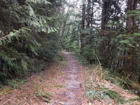
The morning was beautiful and the light coming through the trees was pretty magical.


I had brought my map of the area with me, but the route was well marked at each trail junction.


Heading up one couldn't call the trail crowded -- though we did remark that we saw more people in our first mile on the trail on Sunday than we did all day on Saturday. We did still have a lot of solitude -- at least on the way up.


After a while the route leveled off and we passed this awesome, mossy boulder.


But then it was back up up up.


One thing that really impressed me about this recreation area was the emergency information, with the area dotted with clearly labelled and uniquely named help points -- so that in an emergency, someone could call or radio in with the help point name, rather than try to describe where they are. Having the name, too, rather than just a letter, cuts down on potential confusion / miscommunication. J and K are more easily confused than "Juliet" and "Kayak". 


A little over three miles up, we passed the "official" start of the trail:


And things got really steep again. I don't want to condone vandalism, but I did think this little graffito was nice...


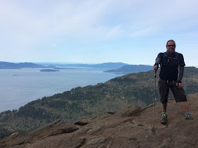
And, sure enough, a few more hills and we popped out onto a large, rocky area and this view:


There were about 10 people at the top, including a group of people talking loudly over each other right next to a woman who clearly had arrived earlier and was trying to write or draw. Poor dear. We moved a little ways away and sat and enjoyed the view. (Bonus: the noisy group later unleashed a drone. Hope for the future: another group of young people asked the drone group to put it away, and they did.)

BTW, Wil has two legs, despite how this picture looks:


"Hi! We're in need of showers."


After a snack and a break we headed back down to Chuckanut Drive. We passed a LOT of people on the way up. A LOT. I was glad that we had gotten an early start!


We liked this hike -- challenging, not super long, and a gorgeous payoff at the end. If we lived closer, I think this would be our "standard" hike.


Oyster Dome Trail

6.9 miles
2024 feet elevation